

We had
a delightful sail to various points of the lake. The air up in these
regions seems even purer and more elastic than in other parts of the
island, the verdure brighter, the foliage richer; and as we float
here at our ease, we are willing to believe that no lake on earth is
more beauteous than Sorell.
John Mitchel

This well-equipped boy scout troop is part of a contingent of more than a hundred eager lads from all over
Australia who detrained at various points between Tunbridge and Ross
and hiked in to camp near Dogs Head for a weekend of
energetic activity in 1927.
In 1933-34 a similar event was organised, this time on the Dogs Head itself. A camp site was established and a stone circle with a flagpole in the middle was constructed to mark the corroboree ground.
Here is the map they followed in 1933.
In 1933-34 a similar event was organised, this time on the Dogs Head itself. A camp site was established and a stone circle with a flagpole in the middle was constructed to mark the corroboree ground.
Here is the map they followed in 1933.

One does not simply walk in to Dogs Head these days

After much persistent detective work and many emails our walk
co-ordinator managed to track down the current owner to get
permission to enter the property. The manager arranged to drive over
from Waddamana, unlock the gate, and warn the shooters of our
presence. We turn up to meet him at Interlaken on a sunny Sunday
morning.
 |
Walks
co-ordinator talks to the property manager
|
 |
the rest of us prepare to walk
|
The area on this side of Lake Sorell could hardly be described as
pristine. Sheep and cattle have grazed here since the early
nineteenth century, generations of wood-cutters have harvested
fenceposts and firewood. The bush is criss-crossed by a maze of old
tracks used by shepherds, woodcutters, fishermen and shooters.


There are two very serious new roads into the property, but as
Bushwalkers we scorn the well-marked route and strike off into the
scrub following a compass bearing.
The first thing we find is an old log-loading ramp, a good place for
morning tea.

A visitor to the area a couple of years ago has given the
co-ordinator a map with various interesting features marked on it,
and the intention is to visit each in turn, making a relatively
short, easy walk into an entertaining treasure-hunt. Item number one
is a volcanic plug. None of us has been here before; nobody knows
what to look for.
First Achievement unlocked
 |
Is
it this rocky knoll?
|
 |
Or this
rocky outcrop that seems to describe a rough circle?
|
We finally settle on a stony protruberance at the highest spot on
this part of the map.

 |
| I can see Lake Sorell from up here! |
 |
| THAT isn't on our map |
Having achieved our first objective, we plunge into the bush again.


We follow an old snigging track, bash our way through a lot of
totally unnecessary shrubbery and scramble over some rocks just because
they're there.

At last, feeling we've proved our point, we relent and
return to the road, which leads us straight to our next objective –
the remains of Thomas Meagher's house.
The Irish Exiles
The
"Dog's Head" . . . is a fine promontory running about a
mile out into the lake, and fringed all round with noble trees. In a
snug cove at the northern side of the "Dog's Head" is a
stone house inhabited by the shepherd in charge of a large flock
belonging to a Mr. Clarke.
We pass
the Dog's Head promontory, and enter a rough winding path cut among
the trees, which brings us to a quiet bay, or deep curve of the lake,
at the head of which, facing one of the most glorious scenes of
fairy-land, with the clear waters rippling at its feet, and a dense
forest around and behind it, stands our friend's quiet cottage. On
the veranda we are welcomed by the Lady of this sylvan hermitage, and
spend a pleasant hour, till dinner-time, sauntering on the lake
shore.
It was 1851, and John Mitchel, on the way home from Ross to Bothwell,
was visiting fellow-exile Thomas Meagher and his wife Catherine. This
is the view he was describing; we stand in front of Mr Meagher's
living room fireplace on the shore of Lake Sorell, with the Dogs Head
in the middle distance.

Mitchel and Meagher were two of six Irish Exiles transported to Van
Diemens Land for their part in the 1848 rebellion against British
rule. As political prisoners they were regarded, and regarded
themselves, as superior to the rest of the convicts.
Having given their word they would not attempt to escape, the
Irishmen were allowed to live as free men, provided only that they
remained in their specified district and reported to the police each
week. Intelligent, educated men, they quickly made friends among the
settlers and to all intents and purposes settled in to colonial
society. Meagher bought the land at Lake Sorell, built a house and
married a local woman, Catherine Bennett. He planted oats and
potatoes, kept livestock and had a couple of men working for him.
Mitchel's wife and family came from Ireland to join him at Bothwell.
 |
| remains of chimney - Thomas Francis Meagher's house |
On the surface they appeared to have accepted their fate, and,
indeed, both Meagher and Mitchel greatly admired the Tasmanian
landscape and climate and, grudgingly, some of its people. However,
their political aspirations and their determination to return home
remained unabated and one way or another each of them “formally
withdrew his parole” and escaped over the next few years. Meagher's
house fell into ruin and all trace of the oats and potatoes he had
planted vanished. His son Henry, born a few weeks after his escape,
died in infancy and is buried in the Roman Catholic cemetery at
Richmond. Catherine sailed for Ireland in 1853 where she died a year
or two later at the age of twenty two. Meagher himself drowned in the
Missouri in 1867.
Having lunched in Mr Meagher's dining room and ticked off item two on
our list, we follow the shoreline to a pretty beach along the side of
the Dogs Head.


Evil Fish
 Mitchel remarked that below Meagher's house a little wooden jetty
runs out some yards into the lake; and at anchor, near the end of the
jetty, lies the "Speranza", a new boat built at
Hobart-town, and hauled up here, through Bothwell, a distance of
seventy-five miles, by six bullocks.
Mitchel remarked that below Meagher's house a little wooden jetty
runs out some yards into the lake; and at anchor, near the end of the
jetty, lies the "Speranza", a new boat built at
Hobart-town, and hauled up here, through Bothwell, a distance of
seventy-five miles, by six bullocks.
The friends enjoyed several
pleasant excursions on the lake, the beauties of which Mitchel
described in extravagant terms. The scouts enjoyed it, too, although
they probably didn't write about it quite so eloquently.

We, alas, had no boat. In fact, Lake Sorell is currently closed to
boating and fishing as the Inland Fisheries Service works to
eliminate European Carp, first identified here in 1995. Carp can only
spawn in the warmer shallows around the edges of the lake, and nets
to exclude them from these areas are proving effective. Various
measures have been taken to eradicate the fish from Lake Crescent,
and it is hoped they are all gone from Lake Sorell. Until this is
confirmed, however, the lake remains closed.
Natural Wonders
Our next objective is the Ice Folds. None of us knows what they are,
either, but according to the map they are on the other side of Dogs
Head.

The top of Dogs Head is a boring, barren, rock-strewn paddock with a
few trees around the edges. On the far side, however, it proves
anything but boring. The rock looks as if it has been split away from
the side of the promontory; or like the ruined defensive walls and
trenches of a vast and ancient fortification. For me, this amazing
formation is the highlight of the walk. Tick number three.


Our next objective is an eagle's nest. I can't resist photographing
this gothic arrangement as we retrace our steps along the promontory

After stopping to inspect every stand of trees somebody suddenly
spots the nest – up there!

Mission Accomplished
The afternoon is drawing on and it is decided to forego a visit to
the site of the shepherd's hut, mentioned by Mr Mitchel and marked on
our map. But the Corroboree Ground is a must.
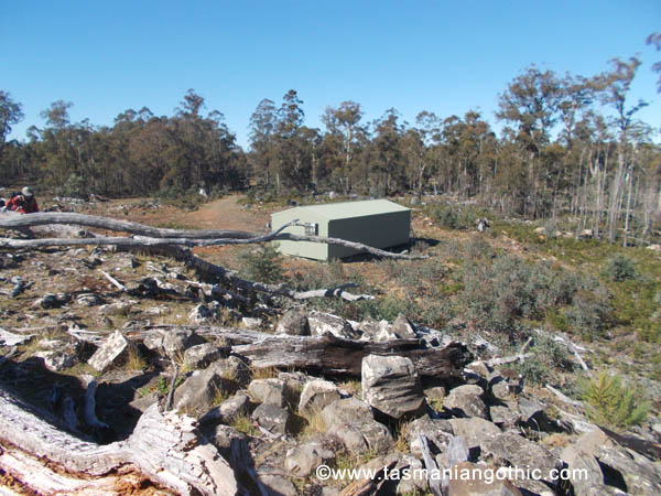
In fact, it's not far past the eagle's nest. There is a small cairn
where the flagpole once stood; the cement is crumbling from between
the rocks, but the date, “1933” is still legible on the top.
Around it is a large circle of stones set neatly in the ground.


Having congratulated ourselves we set off happily to hike back to the
gate. No messing around this time – straight down the road. The
manager and his wife are waiting for us along the way. We chat for a
few minutes then it's back to the cars and home. We have completed
our quest!

ref: quotations are from Mitchel. John. Jail Journal, Or, Five Years in British Prisons. New York. 1854


