I've returned from the
Big North Island, where walks in the ACT consisted of climbing steep
hills covered with dry eucalypt forest. Today's walk couldn't have
been more different: so nice to be back in the familiar surroundings
of a Tasmanian rainforest. Of course, a problem with rainforests is –
rain. Optimistically ignoring an unfavourable weather forecast we
drove all the way in to the southern forests to the start of the
Nevada Peak walk.
Actually, our intended
destination was not Nevada Peak but the slightly closer, not so lofty
Wetpants Peak, probably named by Tom Stevens of the Forestry
Department who surveyed the area in the mid-twentieth century.
You
can look up the reference here:
https://www.placenames.tas.gov.au/
- just type in the place name. And we didn't drive quite to the
carpark, either:
I thought you might like to hear what the stream
beneath the washed-out bridge sounds like:
We had to walk the last
half kilometre.
To our surprise – and
theirs – we encountered three snakes curled up together on the side
of the road; surely it was not warm or sunny enough for snakes to be
out? Of course, by the time I disentangled my camera they were
retreating into holes between the rocks, but you can see bits of two
of them.
Leaving the carpark,
where our cars weren't. Sorry about the rainspot on the lens.
After a short walk on a
waterlogged corduroy road we reached the beginning of the track
proper.
Depending, of course,
on your definition of "track".
 |
| morning tea |
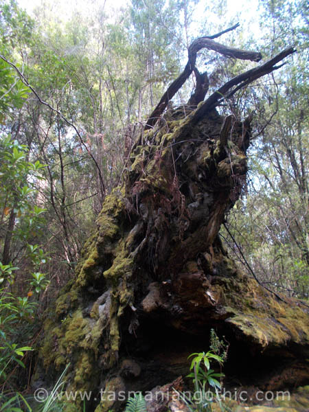
We began a
climb where negotiating the stretches of mud, large pools of water and
flowing streams that passed as a track was varied by scrambling over, crawling under and
balancing on fallen logs in various sizes and stages of decay. With
both hands occupied grabbing vegetation for support, photography was
out of the question. Besides, as we gained altitude the weather
became more and more inclement, with rain and an icy wind. Through the rain and low clouds we glimpsed snow on Nevada Peak.
By the time we reached
Woolleys Tarn we were tired, wet and cold and had had quite enough,
thank you. There were traces of snow there, too.
This is Wetpants Peak. You can see a couple of waterfalls to the left of the picture.
Nobody evinced the slightest interest in climbing it. Even my camera
was feeling the damp and refused to work any more.
So we found a
relatively sheltered spot in the forest among some impressive pandani and ate a
soggy, hurried lunch before retracing our steps.
 |
| The end of a perfect day |
 |
| and we didn't even GET to Wetpants Peak! |